Capital flows to monetisable goods and services, but the funding path for broader economic and social benefits is more obscure. And transport data is no exception.
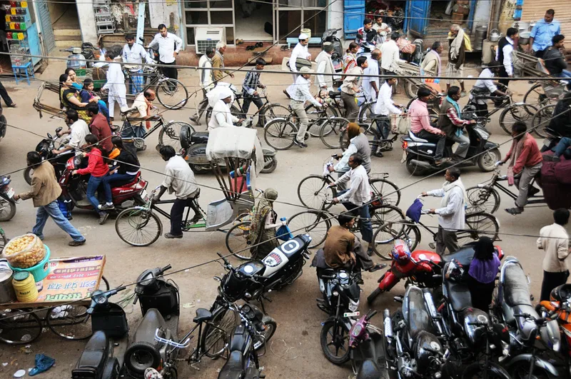
The original journey planners - satellite navigation devices - were launched as ‘pay to use’ devices. Subsequent generations of journey planner have disrupted the paid-for models of TomTom et al. However, the driver-data ecosystem – from base maps to traffic flow and congestion data – has become rich, detailed and lucrative. It’s used not just for journey planning but also to optimise transport operations, for traffic system management and for directing investment.
Whilst public transport data has not been monetised to the same extent, it has developed (despite silos and fragmentation) over the past decade. There has been a recognition that better public transport unlocks broader economic gains and social benefits. Public transport authorities like Transport for London (TfL) have published consistent open data to enhance their services and maximise their impact. Their ‘feeds’ are used in a large number of journey planners. The provision of global standards for transport data has supported these efforts – in particular the General Transit Feed Specification (GTFS) – maintained by MobilityData (an international non-profit organisation).

However, much less reliable information available for journeys by foot, wheelchair or bicycle creates ‘gaps in the maps’, says Sandra Witzel, Skedgo journey planner. "We found that missing and inconsistent data is one of the biggest barriers to creating effective, inclusive travel solutions," she explains. "We often lack reliable details about accessibility - for example, the quality of footpaths or whether stations have step-free access. Important details about cycling routes (are the lanes separated, how wide are they, how steep etc) are also hard to find. Even basic insights like real-time congestion, parking availability, and crowding on public transport can be fragmented or locked behind localised, non-standardised systems. Without this information, it is hard for journey planners to present clear, safe and equitable alternatives to driving.”
Missing maps, rules and algorithms
There are several requirements for comprehensive transport data sets. These are roughly divided into: the base maps (which generally define the infrastructure); the rules (the ‘how’ – road rules, timetables, access to the infrastructure); and real-time information (such as vehicle position, congestion, usage). Algorithms combine information from the data sets - usually to suggest journey plans and routing but also for operational purposes. In addition, data is generated by trips that are actually made – people travelling - by car or public transport through ticketing and mobile phone data.
There is so much data that the gaps are often ignored. However, missing data has real impacts. It includes ‘undocumented’ services and infrastructure – and also extends to those people not travelling. In 2024 the UK's House of Commons Transport Committee heard evidence on the future of transport data. Paul Howell, then an MP, put the problem succinctly. “Your grandmother doesn’t have the phone, so you don’t pick up the data," he explains.
“Whilst standardisation has been adopted around public transport data, there is not yet a consensus about kerbside, pavement and active travel mapping”
"In places like mine where we have villages with people with very low car ownership, very poor public transport, they won’t go from a place like Sedgefield to a place like Newton Aycliffe where there are 10,000 jobs because they cannot get there. There should be a demand pattern but there isn’t - because nobody is going there because they can’t get there.”
The lack of data results in a disparity between the intense analysis of people travelling and the invisibility of those who are not; this exacerbates inequality, economic and social problems. In the realm of walking and cycling these gaps are greater. There are many levels of 'unknown unknowns'.
Data gaps create vicious cycles. “Poor data makes it difficult for people to know that a transportation option even exists," says Isabelle de Robert, regional director, Europe, for MobilityData. "It can also exacerbate inequalities in transportation access: when active travel routes are not adequately mapped, certain groups – particularly those with mobility challenges – are disproportionately affected. Also, without accurate and comprehensive data, it becomes difficult to identify dangerous areas or unsafe infrastructure, leading to increased risk for pedestrians and cyclists. A lack of reliable data also prevents governments and organisations from making informed decisions about where to invest in safety improvements or new infrastructure, perpetuating the cycle of unsafe environments.”

Routing, journey planners and other services sit on top of maps, so their accuracy and utility depends on the quality of the map it is based on. Other than Google and Apple (which use their own maps) most journey planners use OSM – Open Street Maps – which are crowdsourced and updated by volunteers. The quality of the data can be variable globally and even from city to city or region to region.
“OSM as a source for pedestrian and cycle paths is as global as can be,” suggests Stephen Miller from the Transit journey planner app. “Whilst nothing is perfect, the openness of the editing process means we can fix inaccuracies or changes as they’re reported.”
Although at a larger scale, infrastructure looks fairly permanent, the reality is that it is affected by changes in details which are often slow to appear in mapping. New installations of street furniture will affect pavement width (which is important to families with young children in buggies or people in wheelchairs) and road works, street lighting changes or temporary restrictions could mean that routes are no longer passable.
Inputting problem
Maps are only as good as their most recent updates. “Local authorities are required to publish information about road closures and road works,” points out Liz Davidson, QRoutes chief marketing officer. “However, the reality is that sometimes the quality and usability of data comes down to who is doing the inputting. An example would be where work along a section of road means traffic is restricted to a single flow but the definition isn’t specific about whether the work means the bus stop is inaccessible.”
Not only can the infrastructure be modified more quickly than maps record, but their accuracy is also affected by less visible factors. Rules of the road are set by a combination of national transport authorities and local authorities (depending on road classification). They include speed limits, parking restrictions and overtaking regulations. Rules like speed limits and one-way streets are becoming more reliably encoded in digital maps. But newer infrastructure for active travel it is not necessarily as well recorded.
For instance there are around 5,000 roads with a ‘living street’ tag in Paris. Although these streets are intended as walking and cycling streets in the French capital, these rules aren’t reliably used by routing algorithms (a recent test by a contributor found that even Google occasionally routed vehicles down these roads and even through a ‘no entry’ sign). A lack of standardised, digitised rules means that journey planners don’t necessarily produce legal routes – and vulnerable road users are not necessarily protected from cars blindly following them.
In the UK, the Department for Transport has ordered the digitisation of Traffic Regulation Orders (TROs). These regulate parking, vary speed limits and implement other rules. “Traffic orders used to be implemented and then pretty much put in a filing cabinet: digitisation makes them visible and available on an open platform,” says Keith Kelly from kerbside digital solutions provider Appyway.
The plan for digitised TROs in the UK is to provide a future API feed of street rules – from speed limits to parking bays – that can be used by automated vehicles to comply with the traffic law. Whilst there are no plans for unified, public-facing maps, those available through service providers like AppyWay provide a tantalising glimpse of the potential for granular and regularly-updated data on streets, pavements and active travel infrastructure.

Routing algorithms take the mapping data and rules they have access to in order to create routes, or perform other operational functions. Sometimes they can make smart use of their source information. The Transit cycle route ‘engine’ categorises routes based on characteristics that indicate the likely volume of on-street traffic and creates cycle navigation based on this.
Digitising infrastructure
Some authorities are starting to improve their active travel maps and rules. TfL has started work on digitising cycle infrastructure. Data Scotland’s Cycling Open Data portal brings together cycle counter feeds and featured data sets about training delivery and bikeshare. Apps like Go Jauntly have worked with local authorities to upgrade their maps and, in some cases, combine environmental data such as air quality with maps to suggest routes that are greener and calmer for pedestrians. However, this highlights the siloed nature of this data. Go Jauntly hosts a patchwork of maps – some gloriously rich and detailed where authorities and others have collaborated on mapping - and others much sparser with fewer contributors.
“Routing, journey planners and other services sit on top of maps, so their accuracy depends on the quality of the map it is based on”
The biggest challenge is consistency. Sandra Witzel describes the process: “The challenge is magnified by significant regional differences. Some areas provide comprehensive open data sets (for example, Finland), but in other places the information can be outdated or spread across multiple sources with little consistency. This means any attempt to incorporate real-time parking fees, footpath gradients or reliable cycle-lane details must be painstakingly customised for each city or transport network. As a result, travellers with disabilities, cyclists, or anyone who wants an accurate picture of both the convenience and drawbacks of driving often faces a frustrating lack of clarity.”
Whilst standardisation has been adopted around public transport data, there is not yet a consensus about kerbside, pavement and active travel mapping. Besides the Open Mobility Foundation’s Curb Data Specification there is also the Open Sidewalks schema proposal and the CurbLR data specification.
The potential that could be unlocked by better active travel mapping is likely to be underestimated. For instance, TfL calculated the economic benefit of its existing open transport data to provision to be over £100 million per year. Including better walking and cycling in this can only enhance it. After all, every public transport trip requires people to get themselves to a bus stop, railway or metro station.
A further benefit is that detailed mapping provides the basis from which to identify gaps in infrastructure and prioritise improvements. Unbroken safe routes enable people to make the trips they want and need to make. These are often trips about which, historically, no data exists because they could not be made.

The devils are in the details
Improving data requires action at many levels. The core of journey planning is detailed mapping. There is a frustration among those providing journey planning tools (and other digital services that optimise operations) that government does not always recognise the importance of providing granular data about the infrastructure it provides and the rules that govern it – nor that it is uniquely placed to keep this information up to date. It should understand the benefits that can flow from ensuring accessible, detailed and real-time geographic information for all its estate.
Additionally, a step towards breaking down data silos is the creation of suitable, easily adopted, standards for walking/wheeling, cycling and micromobility (in the way that GTFS has become the go to specification for user-centric journey planning). This requires agreement on which features are important – from pavement widths to tactile paving, steps to lighting, as well as agreement on the structure of data provision. The mark of success would be that data held by local authorities (for instance on road regulations and infrastructure provision) could be used by journey planners.
Standardisation of behaviours and underlying rules or laws is also important. For instance, pavement parking is banned in London so pavement widths are more reliable for journey planning purposes. Outside London there is a permissive regime and inconsiderate parking reduces actual pavement widths so wheelchair users and families with pushchairs can find safe routes impassable.
Standards for updating maps with permanent and temporary changes, time-dependent data (e.g. restrictions that are in force at certain times of day) and, eventually, real-time data are also required.
Better standards and data will be necessary for the advent of connected vehicles to ensure that they comply with traffic laws and restrictions. However, this innovation should – in tandem - ensure that people on foot, wheelchair or cycles have accessible, well-described and protected space. The most beneficial journeys – for health and well-being as well as local economies and communities – should be the easiest and most pleasant.